Welney Flood System
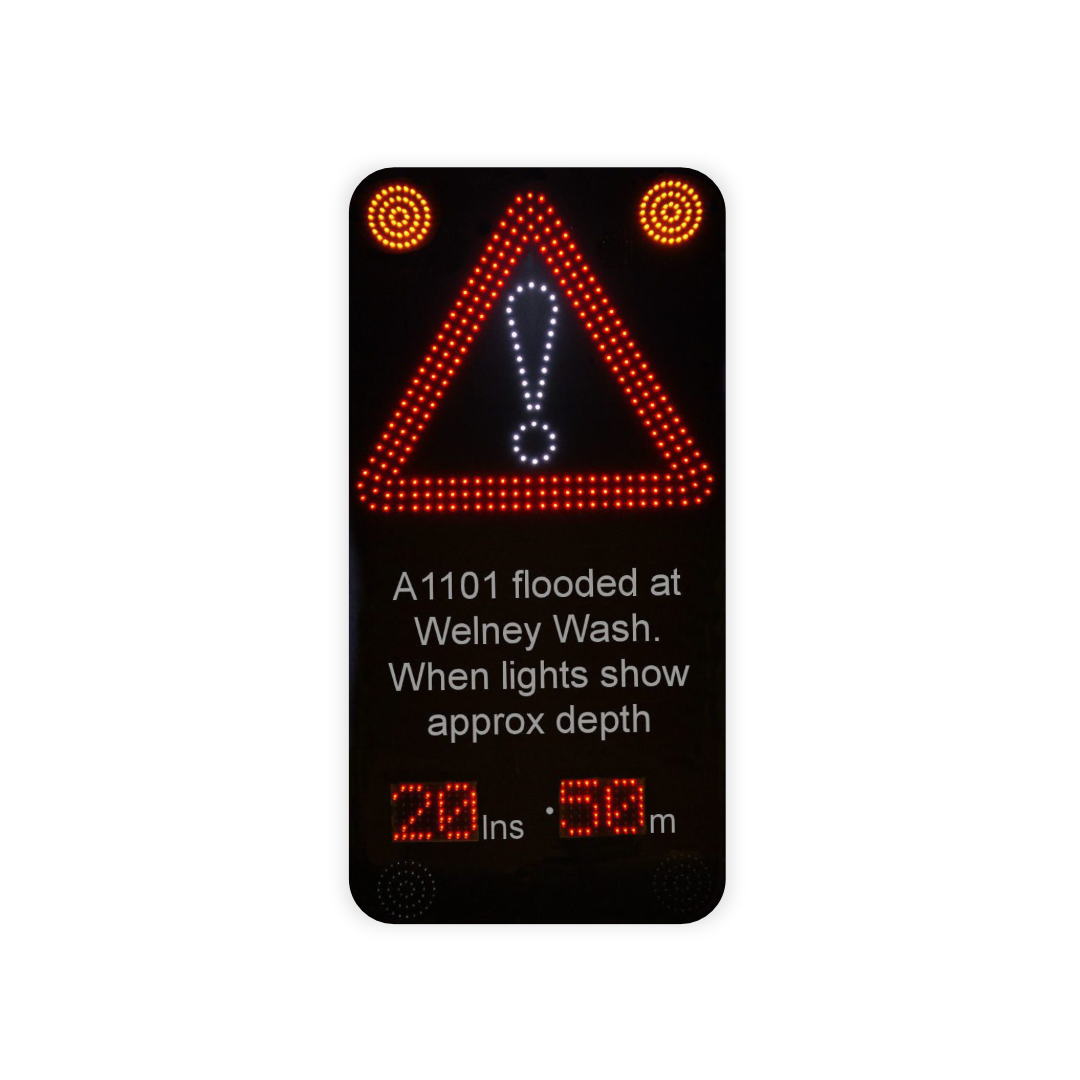
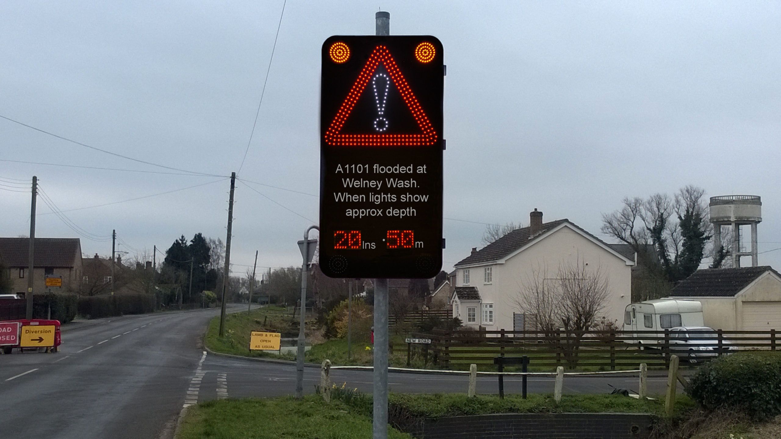
Members of the team at Westcotec are pleased to bring you the latest in the ongoing series of stories behind their signs. The latest ‘Sign of the Times’ takes us to Welney, a small village between Cambridge and King’s Lynn, where our network of water level signs have been assisting the volunteers who run the local flood watch scheme, as well as helping to reduce the number of expensive rescue operations for vehicles disabled by floodwater.

What’s the background
Britain’s lowest road, the A1101, runs almost uninterrupted for 53 miles between Bury St Edmunds in the south-east and Long Sutton in the north-west. For most of its length it is barely above sea level. Not surprisingly it is at frequent risk of flooding, particularly in and around the village of Welney. A network of Westcotec signs now offers flood level information for drivers, which a recently-formed local volunteer group also shares – for journey planning purposes – on its Facebook page.
About the location
The A1101 forms the main link between Lincolnshire and the Fenlands and offers the only direct road connection between Suffolk and Lincolnshire, so when flooding occurs it can lead to significant disruption for drivers. It crosses the Old Bedford River, the River Delph and the New Bedford River at Welney.
These rivers were man-made and date from the 17th and 18th centuries, where they were designed to assist with flood relief in this wide area of low-lying land. This reduced the risk of serious flooding on the River Great Ouse, which drains into the North Sea near King’s Lynn.
The Environment Agency has not been willing to agree to raising the road in this location, nor to kerbing it, in part because of its Site of Special Scientific Interest (SSSI) status. During times of flood, the road would be closed by the Highways team using cones and a gate. However farmers in tractors who knew they could pass through the flood tended to move the cones and leave the flood gate open. Subsequent vehicles were not aware of how deep the flood was, and many ended up stuck after trying unsuccessfully to get through.
How it works
In the Spring of 2014, the first in a series of strategically-placed water level indicator signs, designed and installed by Westcotec, have saved Ken and his colleagues from the potentially risky journeys into the floodwater, as well as leading to a significant reduction in vehicles stranded by floodwater.
This has also greatly eased pressure on emergency services to provide rescue operations in rising floodwater.
“The water usually follows the course of the rivers, but in periods of high rainfall the water levels rise and drain out through the Ouse Washes,” Ken explained.
“The water level will rise over the A1101, and the higher it goes, the more dangerous it becomes for vehicles to get through it. “The highest we have recorded is 4.13 metres in 2003, but the flood trigger is set at
2.4 metres.”

Results
Since the signs were installed, there have been far fewer incidents where vehicles have been stranded and required emergency rescue, according to Ken Goodger.
“If we could get the powers that be to raise the road, that would remove the problem altogether. But as that’s not going to happen we are committed to working with Westcotec
to ensure the information on water levels is shared and drivers can make informed
decisions”
“We look forward to a new era for the signage, with even better information and the
possibility of displaying the data in other languages.”
The Westcotec overview
Olly Samways, Westoctec’s Sales Director, said: “We are very pleased to have worked with two supportive local authorities and the dedicated team of volunteers at Welney. They understand the importance of providing accurate information from which drivers can make informed decisions. As a result, incidents have reduced, as have emergency call-out costs.
“This is an excellent example of community collaboration, and demonstrates our willingness
to deliver a workable, value-for-money solution based on detailed and thorough
understanding of the relevant issues at Welney.”
